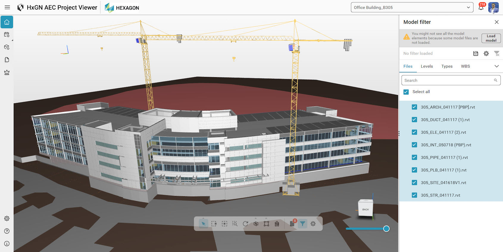
A cloud-based project viewer that enables the visualisation, federation and control of project data leads the raft of new products launched by Hexagon at its Hexagon Live event in Las Vegas this week (12-15 June).
The HxGN AEC Project Viewer from Hexagon Geosystems connects model, schedule and document management processes in one cloud solution to “improve visibility, collaboration and communication in construction projects”, according to Hexagon. The viewer supports the transition from 3D models to 5D construction management by adding time and cost insights.
Using the AEC Project Viewer mobile app, users can access models and schedules from anywhere to stay updated.
The viewer is compatible with Hexagon construction solutions and other software suites.
Kevin Holmes, vice-president of building solutions at Hexagon Geosystems, said: “To visualise progress and identify changes, AEC Project Viewer can serve as a single pane of glass for office and field teams. [The viewer] effectively visualises design or schedule updates to ensure that they are easily understood and actionable for project stakeholders and team members. Our cloud solution will enable construction companies of all sizes to take an important step towards BIM-based construction processes.”
Reality capture for digital twins

Another highlight of Hexagon Live was the launch of Reality Cloud Studio. This is an SaaS application that enables users to upload reality capture data to the cloud for automated processing, storing and visualisation to create photorealistic digital twins, and to share data quickly and securely.
Users can access Reality Cloud Studio from any computer or mobile device with a web browser. Users in the field can upload data directly from compatible reality sensors to create registered and meshed digital twins for use on site, with a few taps on a smartphone or tablet, Hexagon said.
The interface performs tasks such as automated registration and meshing of point clouds captured by any sensor that produces a compatible file type. Users can collaborate in real-time with measurements, annotations, attachments, comments and virtual tours.
“We are at a point in reality capture where a unified, scalable and simplified digital reality experience is necessary to make digital twins and their value accessible to everyone,” said Thomas Harring, president of Hexagon Geosystems. “Reality Cloud Studio provides a space where anyone can access and build digital twins and share their vital information, using valuable communication tools that bring people and data together in a centralised space for digital reality.”
Faster handheld laser scanning
Meanwhile, Hexagon also announced developments for its Leica products. It will launch the BLK2Go Pulse handheld laser scanner in early 2024.
The Pulse combines Sony’s Time of Flight technology and Hexagon’s simultaneous localisation and mapping technology for rapid data acquisition and real-time processing. Time of Flight image sensors measure the time delay between when the light is emitted and when the reflected light is received by the camera.
Hexagon expects the Pulse will be primarily used for short-range indoor applications.
Hexagon also announced the Leica Geosystems CountryMapper, which combines a large-format photogrammetric camera with a high-performance LiDAR in a single system for aerial mapping.
The imaging and LiDAR systems cover the same area simultaneously, “ensuring maximum temporal and geometric data consistency”, Hexagon said. The hybrid system maximises the accuracy of the collected data and enables the generation of 2D and 3D products, supporting applications such as orthophoto generation, terrain mapping, hydrography, forestry monitoring and infrastructure management.
Don’t miss out on BIM and digital construction news: sign up to receive the BIMplus newsletter.


