Ian Tansey, managing director of ProDroneWorx, on the growing demand for rooftop extensions – and the role drones can play in their planning and design.
With a lack of sites for new developments in congested cities we should start to see more momentum in building upwards to create additional residential and commercial space that’s required for our growing populations.
Whether it’s on top of existing blocks of flats, commercial properties such as office blocks, shopping centres, industrial units or warehouses, the potential scale of “rooftop development” is enormous across the UK.
Knight Frank estimates that 40,000 homes could be built on top of existing buildings in central London alone, while Homes England has also provided funding to encourage this type of rooftop development.
Using survey grade accurate 2D/3D digital outputs from a drone survey to create CAD or scan-to-BIM models can significantly aid roof top developments by assisting all parties involved in in the planning, design, construction and marketing of the project, including architects, planners, developers and construction companies.

ProDroneWorx can capture the digital data required by an architect or designer to produce a 2D CAD or 3D Revit model
Using the latest development in RTK/PPK (real-time kinematic and post processed kinematic) drone technology, ProDroneWorx can capture the digital data required by an architect or designer to produce a 2D CAD or 3D Revit model, achieving sub 20mm global accuracies on the X and Y and 20-30mm on the Z value.
The RTK/PPK-enabled drone captures real-time, centimetre-level positioning data for improved absolute accuracy on image metadata. The system is connected to an RTK high precision GNSS (global navigation satellite system) mobile station setup over a known point for global accuracies tied into the OS or local grid.
Due to the high resolution camera used the RTK system can achieve a ground sample distance (GSD) of less than 1cm.
ProDroneWorx carried out a survey grade accurate drone survey on a project in central London as it was not possible to capture the digital data required using traditional surveying techniques due to major access restrictions and working at height issues, for example terrestrial 3D laser scanning. Using a drone we had unrestricted access to all parts of the roof enabling us to capture the digital data required.
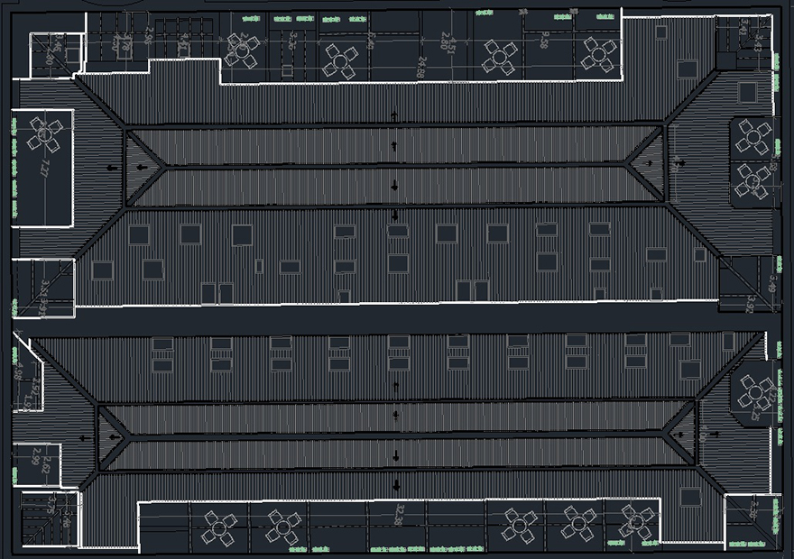
The survey grade accurate 3D point cloud, 3D mesh and 2D orthomosaic were used to create a 2D CAD model and a 3D Revit/scan-to-BIM to aid the planning and design phase.
As more and more companies within the construction and asset management industries become aware of how the digital data from drone technology can be used to create CAD and Revit/scan-to-BIM models, we expect to see large growth in this area.
Comments
Comments are closed.


What a great way to use the digital outputs from drone technology, I’m surprised more developers and architects are not using this technology to help them in their planning and design process.