The Digital Construction Awards attracted more than 140 entries, 62 of which have been shortlisted. Here we detail the shortlist for the Best Use Of Data On A Project.

This category, sponsored by nima, recognises the use of data to enhance design, construction processes or asset management on a building or infrastructure project.
Six entrants made the shortlist, including Sir Robert McAlpine, Vinci Construction, Skanksa, Costain, and NG Bailey.
Baird Family Hospital and ANCHOR Centre Aberdeen | Graham Construction with NHS Grampian
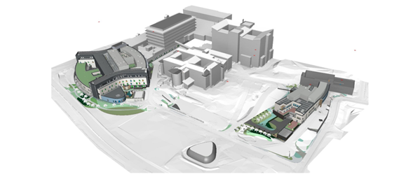
The £244.8m Baird Family Hospital and ANCHOR project is the largest procured through the Health Facilities Scotland Framework. It will modernise patient care as part of NHS Grampian’s continued investment in new and improved facilities.
The client challenged main contractor Graham on the handover and acceptance process. It demanded more visibility and real-time information via a single, clear platform that all parties could use. With more than 2,000 spaces/rooms on the project, Graham’s response would be critical to project performance.
The contractor was determined to develop a visual, real-time data capture solution to manage status updates, handover and acceptance of each room. The system had to be intuitive for subcontractors to populate on the ground and for clients to use for reporting purposes.
Graham deployed QR codes and BIM 360 Field software that combined mobile technologies at the point of construction with cloud-based collaboration and reporting. A unique QR code for each space/room enabled all quality records and issues relating to that space to be digitally stored and collated in one virtual place. When a subcontractor entered the space, they scanned the code and populated their activity data, confirming the room status.
This data uploads onto a live reporting system every morning via a SharePoint link. The site administrators and subcontractors are then notified instantly of the live status of any given room.
The subcontractors also use the technology to complete their own quality checks and handover for acceptance to the following trade.
The PowerBI platform handles the reporting.
Digital transformation for EKFB information management on HS2 Phase 1 | Laminar Projects with EKFB (Eiffage, Kier, Ferrovial and BAM Nuttall)
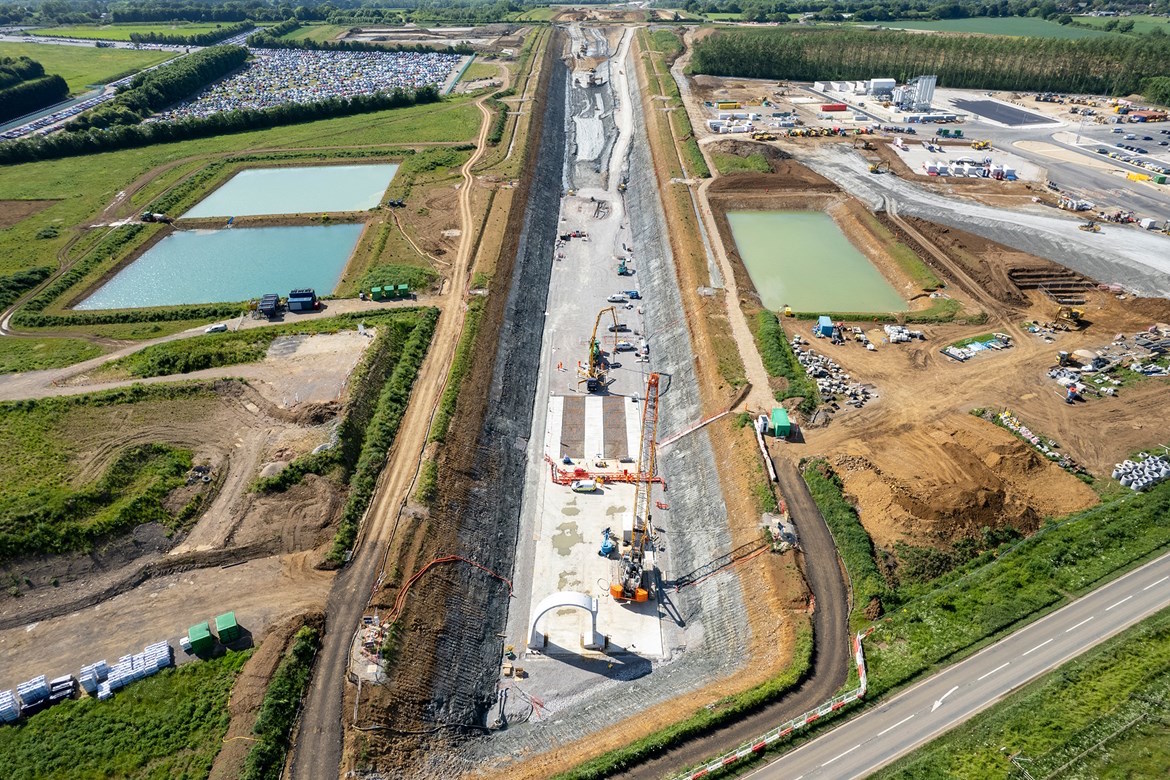
Laminar Projects has delivered significant savings to the Eiffage, Kier, Ferrovial and BAM Nuttall joint venture (EKFB) working on HS2, thanks to its approach to digital transformation.
On such a complex project, there were many data challenges. First, there were many siloed systems across multiple organisations. For example, three systems in EKFB, one from HS2 and another among the supply chain-controlled deliverables. This made informed decision-making extremely difficult.
Second, a system infrastructure was required to handle the high volumes of data generated. The EKFB team had been using SharePoint Lists, but it was not suitable for the HS2 project.
Third, existing processes had been developed using traditional, sequential ways of thinking rather than embedding digital technology in the process from the start. This often generated additional work for people to administer or populate the various systems.
Fourth, Laminar wanted to avoid any issues arising from poor data quality and control as they would be magnified on such a large project.
Ultimately, Laminar built a cloud-based data warehouse (hosted on Azure) with live pipelines from data in the siloed project systems. This enabled timely access to the latest project information and accommodate the high data volumes.
Via PowerBI, project stakeholders can access interactive dashboards with information about how processes and key deliverables are progressing. The dashboards also highlight data inconsistencies to guide resolution.
Total time savings thanks to Laminar’s work equates to £10.3m annually.
Information management tool | NG Bailey
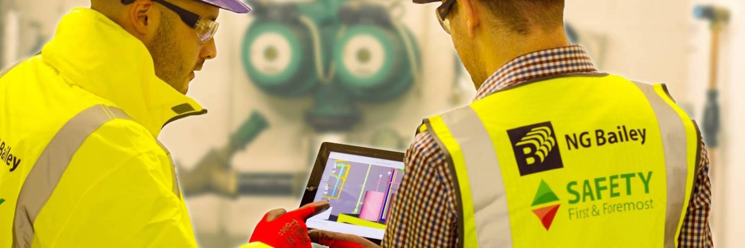
MEP specialist NG Bailey has created a bespoke information management tool.
Its features include:
- The ability to separate data and information from models and to manage it independently. In the click of a button, data can then be synchronised back to the project model.
- A suite of tools for mapping and automating classification, saving the time needed to manually look up and enter data.
- The capability for the user to issue information requests directly to third parties and populate the data into the tool, automating what is usually a convoluted process.
- If a model already contains a TSI code, information and documents can be automatically populated from the Luckins database (of building services products, brochures, specification sheets and images). This reduces the time that is usually required to obtain information and input into the model. This can then be merged directly into a COBie workbook.
- A real-time dashboard that provides managers with a way to report and measure the progress of data population.
On a recent secure defence contract, the tool has been used to collate and manage all type-data. The data requirement for this project was significant. It included the need to name 200,000 pieces of data in line with a project-specific standard.
Without the tool, the work would have been done manually, taking months and subject to human error. The tool allowed this work to accurately name all 200,000 items in less than a minute with 100% accuracy.
Royal Bournemouth Hospital | Buildots with IHP (Vinci Construction/Sir Robert McAlpine) and University Hospitals Dorset NHS Foundation Trust
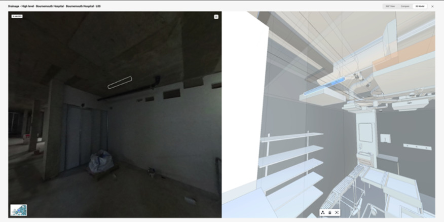
The Vinci Construction UK/Sir Robert McAlpine joint venture, Integrated Health Projects (IHP), has deployed Buildots’ helmet-mounted 360-degree camera technology for site monitoring on the extension of the Royal Bournemouth Hospital.
This is the first hospital facility to be built in the UK using the technology.
Buildots automatically analyses data captured at the site via helmet-mounted 360-degree cameras. The platform then generates progress reports supported by visuals, providing managers and stakeholders with accurate, objective data and in-depth analysis.
Buildots’ sales and customer success teams undertook an extensive discovery process. They worked with all of IHP’s teams – from planners and BIM managers to project directors to operations directors – to understand what information was valuable to each person, ensuring they would get the most out of the platform. With this information, they built a bespoke platform using the project’s programme and BIM model.
One of the most widely adopted features has been the weekly planning tool, which has allowed the IHP team to engage with trades on site. Having everything written down on an easy-to-use platform has allowed IHP to overcome the language barriers of the past, minimising mistakes and boosting efficiency.
Skanska Costain Strabag JV and Esri UK: Smart permit to dig on HS2 | Esri UK with SCS JV, HS2
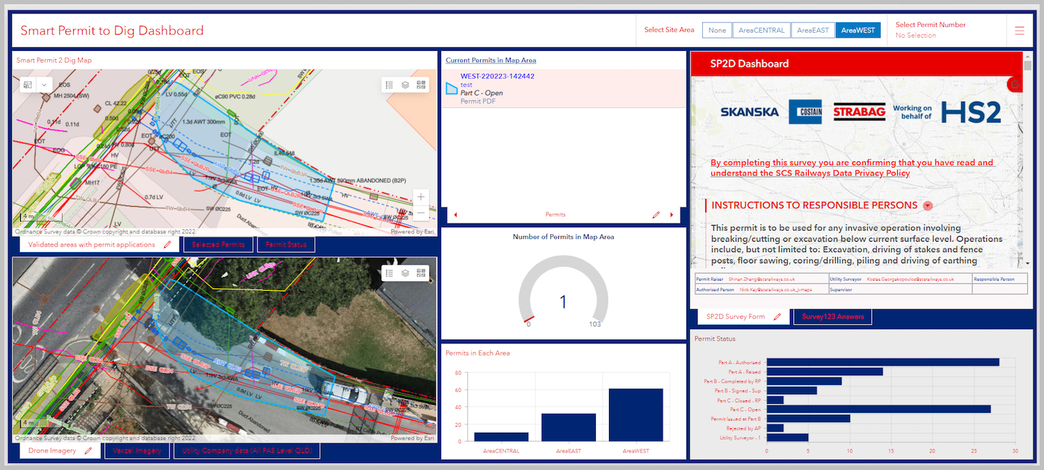
HS2 has significant challenges around minimising utility strikes. The Skanska Costain Strabag joint venture (SCS JV) is delivering the final 26.4km of HS2 to Euston, its southern terminus. This contract includes some of the most built-up sections of the route, containing infrastructure from 20 different utility providers.
While the National Underground Assets Register may solve this issue in the future, the SCS JV needed a solution in the present.
Thus the SCS JV used Esri’s ArcGIS software to create a Smart Permit to Dig application. The app ensures an appropriate permit is issued before any excavation work is carried out. The Esri platform allows SCS JV to initiate a Permit to Dig application and view all submitted applications.
As well as digitally replicating the existing permit process, Esri’s platform includes a scalable map showing a single accurate and reliable account of the latest underground utilities for a permit area.
The utilities data integrated and mapped in the new system has been verified by site engineers and is deemed to be the most reliable and current model, containing information from all providers and site surveys.
This not only helps avoid utilities strikes and makes the project safer, but also makes the permit approval process far more efficient.
Using AI and ML to facilitate sustainable city design at Arup with Amazon SageMaker | Amazon Web Services with Arup

Arup wanted to scale data analytics for sustainable urban planning and construction clients – instead of building from scratch each time.
Before they began using Amazon SageMaker, Arup specialists worked independently on each project. They used open-source machine learning (ML) tools that they customised and maintained. With significant jumps in the scale of data to analyse, projects faced increasing costs and complexity.
Furthermore, teams were spending time reviewing open-source licensing, managing dependencies, and validating security standards of ML tool stacks on top of the data science work. They also had to continuously patch, upgrade, and maintain development environments manually for the duration of each project.
Thus, Arup data scientists built the Arup Data Platform using a suite of solutions available from Amazon Web Services. For data science and analytics, the company used Amazon SageMaker to build, train and deploy ML models for virtually any use case with managed infrastructure, tools and workflows.
To further enhance ML capabilities, Arup decided to incorporate SageMaker’s geospatial capabilities. This enhancement provides specialised features that facilitated geospatial data analyses and the application of ML models on geospatial data.
The enhanced Arup Data Platform streamlined and standardised internal processes and generated predictions from geospatial data. This improved Arup’s ability to help its clients make more sustainable decisions in urban design and planning.
Celebrate with the best
The winners of the Best Use of Data on a Project category, alongside the victors of the other 11 categories, will be revealed at the awards dinner on 4 July at the Brewery in London.
You can join them by booking your places at the awards. There is an early bird discount for those who book tables before 5pm on 19 May.
The Digital Construction Awards celebrate best practice and reward innovation in the application of BIM and digital technology in the built environment sector.
The awards are run by Digital Construction Week, the Chartered Institute of Building, and Construction Management and BIMplus.
Awards sponsors include the Association for Project Safety, BIMcollab, Bluebeam, Everwarm, Graitec, nima, Procore, Revizto and Sir Robert McAlpine.
Don’t miss out on BIM and digital construction news: sign up to receive the BIMplus newsletter.


