With the growing use of unmanned aerial vehicles in construction, managers can get the most from the technology by keeping up to date with the regulations that govern their use, says Roy Amos.
Aerial data capture by drones using onboard sensors, coupled with sophisticated, modern software for data processing, now present an opportunity to change for the better the management of all phases of the lifecycle of construction projects.
Construction firms and their clients are becoming better educated about how drones may benefit them, and more imaginative in their application. Drone use was once limited to aerial still photography or video, used to monitor progress on sites or for marketing.
Now drones are being used in a wider arena during pre- and post-contract phases. Their uses include design and 3D modelling, thermal imaging, defect inspections and asset condition surveys, to name but a few.
The growth in drone use, in construction and other industries, has the potential to bring benefit to business operations and workflows. But does the proliferation of the technology bring challenges with it? Almost certainly.
This CPD will look into some of the more important factors that those managing projects will need to consider to successfully procure and facilitate safe, regulatory compliant and effective aerial data capture using drones.
Regulation and compliance
The UK has a well-established regulatory framework governing the use and commercial operation of unmanned aircraft. While the vast majority of commercial operators of drones comply strictly with these regulations, some may fall short or act in breach of the minimum requirements and standards.
This poses a challenge for those managing construction projects where drones are to be used. To what extent should construction professionals be aware of the regulations governing drone use on their sites, so as to be equipped to intervene and prevent their illegal operation, if required?

Drones can collect data from sites at up to 122m above ground level
The answer to this important question should be considered in the context of how regulatory compliance may be in conflict with drone operators’ commercial and financial interests. For example, it is not unheard of for some drone operators to undertake work in breach of the minimum distances to be maintained from congested areas without having the appropriate Civil Aviation Authority (CAA) exemptions in place – all so as not to miss the opportunity for paid work in a competitive marketplace.
With this in mind, it necessarily follows that those managing construction projects where drones will be operated should take time to gain a basic understanding of the regulations which govern their use.
Current regulations – the basics
No drone may be operated commercially (for any form of consideration, monetary or otherwise) in the UK without the operator holding an appropriate permission issued by the Civil Aviation Authority, a Permission for Commercial Operations (PfCO).
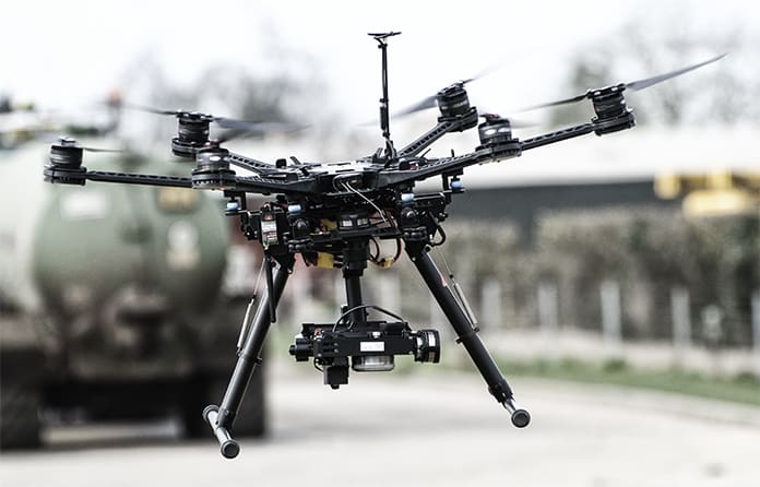
Drones are currently classified by weight and by whether they are carrying a sensor that can be used to collect data. Weight categories are: 0-7kg, 7-20kg, and 20kg and over, while classification by sensor uses the categories of small unmanned aircraft (SUA) or small unmanned surveillance aircraft (SUSA).
A small unmanned surveillance aircraft weighing 0-7kg may be operated under a standard permission within a congested area (a significant proportion of commercially operated drones fall into this weight category). However, the drone must not be brought within 50m of any person, vessel, vehicle or structure that is not under the control of the drone operator, save during landing and take-off when this distance is reduced to 30m.
Larger drones in the 7-20kg weight category may not fly over or within 150m of a congested area. A congested area in relation to a city, town or settlement is defined as any area which is substantially used for residential, industrial, commercial or recreational purposes.
A standard CAA permission requires that a drone is operated:
- Within visual line of sight (VLOS). This is recognised as being 500m and visible with the naked eye (unaided sight).
- At a height not exceeding 122m (400ft) above the take-off point.
A commercial operator must operate in full compliance with all current regulations, his permission and operations manual, unless he seeks appropriate exemptions from the CAA.
All commercial drone operators are required to hold and maintain insurance which meets the requirements of EC Regulation No 785/2004. An operator should only fly a drone if he is satisfied that the flight can safely be made.

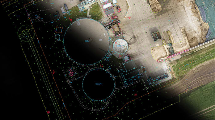
Traditional ground-based total station survey combined with dimensionally accurate drone image
Future regulation
The spread of drone technology is likely to lead to further regulation governing drones and their use in the UK. It is advisable that all who may procure the services of a commercial drone operator keep up to date with the unfolding and developing regulatory landscape governing the operation of drones.
In the United States, it is already federal law that all drones over 250g are registered with the Federal Aviation Administration (FAA). It is likely that the UK will follow suit this year by establishing a similar system for drone identification and registration.
Drone pilots are required to undergo formal training and qualification before they are allowed to operate commercially, but a flight safety test may soon also be mandatory for hobbyist drone pilots.
In addition to regulation, the UK may also see increased police powers to deal with those that operate their drone illegally.
Sourcing drone operators
Other than standard regulatory compliance, those managing construction sites and seeking to secure a commercial drone operator to perform aerial work, should also consider the following:
- Has the operator undertaken work on construction sites or similar environments in the past? If so, what is the extent of this experience? It is prudent to check that the operator is competent to safely and effectively plan and manage the work in the environment in which it is to be completed.
- Does the operator have knowledge of and experience in collecting the type or types of data you require of them?
- Does the operator possess suitable drone and sensor equipment to safely and effectively acquire the data you need?
Failure to address these questions may be at the expense of flight safety and the effectiveness of the planned aerial work.
Be clear about the brief
There can be much complaint about the failure of drone operators to secure the types and quality of data that clients expect. While this may be the consequence of using an inexperienced or inappropriately equipped operator, the problem may also rest with a client having failed to deliver a clear brief. If the client is not suitably prescriptive as to what data he requires and how he intends to use it, an operator may stand little chance of meeting his needs.
Be clear who owns the data
The value in completed aerial work is not in the drone but in the data which it collects. It is important to reach a common understanding with the operator in relation to the following:
- In what output format is the data required to be delivered by the drone operator?
- Who will own the collected data?
- If use of the data is given under licence by the operator, are there any restrictions imposed as to how the data may be used?
- Is the drone operator permitted to use the collected data for his own purposes, in any manner he sees fit? If yes, is this acceptable to you – and, if applicable, your client?
- Is there any sensitivity around the collected data regarding confidentiality? If so, how is this to be managed?
Working with the drone operator on site
Having established your data needs, secured and briefed a suitably qualified, experienced and equipped operator who has worked with you to carefully plan the safe execution of the aerial work, the next step will be to carry out the drone flights on site.
Coordinating aerial work with construction operations can be complex. But some key things will enable the flight to run smoothly.
Make sure that you have received in-date copies of the following: the operator’s insurances; a flight planning pack including risk assessment; documents confirming the pilot’s qualifications; and the operator’s Permission for Commercial Operations.
See that the drone operator and his team are site inducted and allow the operator to conduct his own survey of the site before any flights take place.
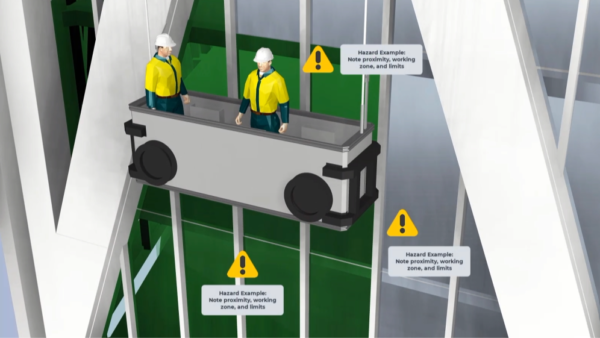
Confirm to the operator any particular site hazards which he should be aware of and which could compromise the health, safety and welfare of his team or impact the safe execution of the planned flights.
Discuss and agree with the operator the optimal timing and safe operating locations needed for the planned flights to take place, as well as the emergency procedures in the event of aircraft failure.
See that site operatives affected by the planned flights are informed when and where the flights will take place and, if appropriate, are placed under the control of the drone operator in order to protect their safety.
Allow the operator to confirm that he is satisfied that it is safe for the flights to take place. Do not place pressure on the operator to fly if he does not consider that it is safe to do so. Remain mindful of how your behaviour could affect the drone operator’s decision-making.
Do not distract the drone operator or his team, or allow others on the site to cause distraction. For example, talking to the drone operator during a flight could cause him to be distracted from maintaining control of the aircraft. This may compromise flight safety.
Consider the impact of the planned aerial data capture on privacy. If appropriate, undertake a privacy impact assessment (PIA) and implement any mitigating action.
In summary
In time, drone operators will better understand the needs of their clients and become trained accordingly. Those procuring the services of commercial drone operators will continue to be better informed about how drone technology may benefit them. Education on both sides remains the key to growth in the safe and effective operation of the technology across the industry.
Roy Amos is managing director of Panodrone

The main uses for drones in construction
Photogrammetry and LiDAR
Photogrammetry is the process of collecting overlapping still aerial images of land, land features and/or buildings to create a detailed and dimensionally accurate 3D model or 2D aerial map.
LiDAR (Light Detection and Ranging) is a form of airborne laser scanning, which can be used to generate similar outputs to those produced from photogrammetry. Its principal advantage is that level information can be gained from beneath vegetation cover and tree canopies.
Uses
- Topographical surveying
- Informing design and design decisions
- Importing new design into a real-world context
- Quantification and measurement of lengths, areas and volumes (increasingly used for measurement and valuation of completed construction work)
- Reconciling as-built data with the proposed or intended design
Inspections
The use of drones to undertake high-level inspections, mitigating the need for costly access solutions and working at height.
Uses
- Asset condition surveys
- Searching for building defects and / or defects in completed construction work
General aerial still photography and video
The process of using drones equipped with gimbal stabilised still and video cameras to capture data from a unique aerial perspective.
Uses
- Progress photo-graphy and video
- Marketing/showcasing projects
Thermal imaging
The process of equipping and using a drone with a thermal imaging camera to gain information relating to temperature and temperature differentials.
Uses
- Leak detection (often used to detect leaks in flat roofs)
- Assessing the thermal performance of building envelopes
- Searching for defects causing heat loss in completed construction work
Take the test online
Click here to see the questions relating to this article


